
Authored by Malcolm Harris

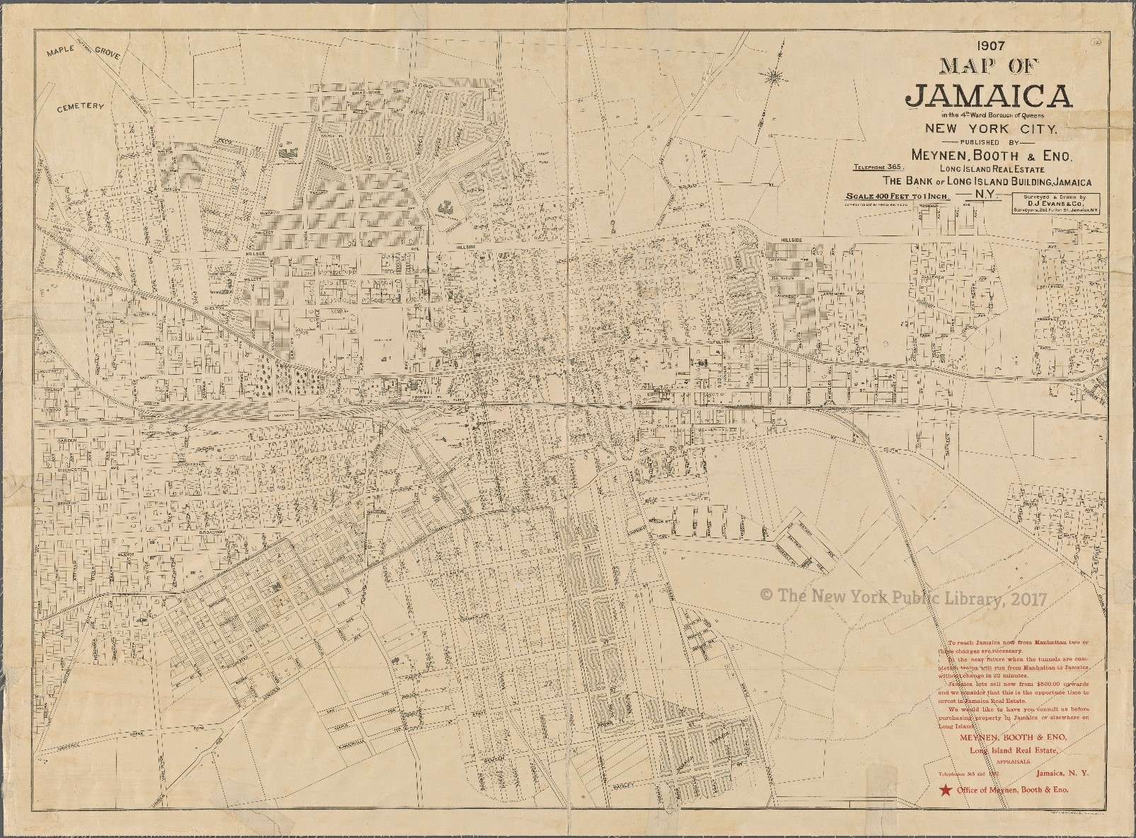
Surveyed and Designed in 1907 by D. J. Evans and Co. and published by Meynen, Booth, and Eno Long Island Real Estate
This map of Jamaica, Queens created in 1907 by the surveyor firm D. J. Evans and Co. is a representation of the urban development that occurred following a surge in new residents to the city. From the beginning of 1900 – with the population of Jamaica, Queens being estimated at almost 153,000 – there is steady growth that occurs leading to the city being the home for just over 248,000 people by 1910.[1] This map is created for the local real estate company of Meynen, Booth, and Eno[2], who like other small relators in the area looked to capitalize on the recent redevelopments of the LIRR, which was electrified for faster service by rail by 1908 as well as the opening of the Queensboro bridge to direct vehicle travel from Manhattan to the outer parts of Long Island.[3] [4]